First major cold front brings cocktail of wild weather to SA
South Australians have woken up to the aftermath of the first major cold front of 2025, with parts of the state lashed with rain, while others were wrapped up in orange dust.
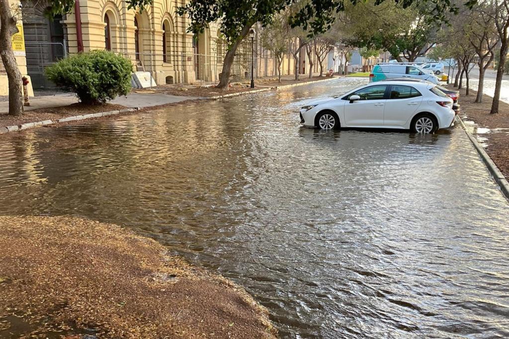
The wild weather swept across the state on Monday, bringing destructive winds, flash flooding and widespread power outages.
To 9am on Tuesday, the Bureau of Meteorology recorded rainfall totals up to 43mm over the last 24 hours, while wind speeds reached 120km/h.
Port Lincoln received 9.4mm, 15mm was recorded in Mount Gambier and the Adelaide CBD; there was 18mm at Victor Harbor and 31mm in Mount Barker.
The highest recorded total was 43mm at Millbrook in the Adelaide Hills.
On Monday afternoon, SA Power Networks recorded 9500 customers without power, including around 166 reports of damaged wires.
As of Tuesday morning, 31 outages remain, with approximately 2000 customers still in the dark, including the Sacred Heart Marcellin Campus.
A post shared to Facebook by the school said power is not expected to be restored on Tuesday.
You might like


“As a result, Marcellin Campus is officially closed to students today,” the post said.
“This includes CEA activities, library study and any other out of hours events.”
The school will continue classes online and is expected to resume on Wednesday.

A widespread severe weather warning was issued as abnormally high tides battered the coastline.
Waves washed away sand dunes and crashed into jetties, with planks of the Port Noarlunga jetty damaged and dislodged.
The Beach Hotel at Seaford and the Emu Hotel in Morphett Vale were among the hospitality businesses forced to close, while Sealink Kangagroo Island cancelled Tuesday morning departures from Cape Jervis.
Stay informed, daily
It’s the rainfall authorities hope will break up an algal bloom on the Fleurieu Peninsula.
However, the Minister for Primary Industries and Regional Development, Claire Scriven said it is too early to tell.
“What we were hoping for, choppy seas, high winds, all of that is what we understood would assist to dissipate the bloom,” she told ABC Radio Adelaide.
“Now it can take maybe up to about a week to know that for sure.”
It was a different story near South Australia’s borders and northern regions, as Port Augusta and Renmark recorded 0mm of rain, while Ceduna received 0.4mm.
Following months-long drought conditions, strong winds led to dust storms throughout the Mid North and Flinders districts.
Orange clouds reduced visibility and prompted road closures, with haze since reaching parts of Victoria and New South Wales.
Scriven said farmers will feel the effects of the weather.
“The loss of the topsoil for those, particularly grain growers who had dry seeded, they’ve potentially lost that, which is huge, huge expense, as well as obviously a lot of that feed is being grown, not just just for for grain and export, but also to feed livestock,” she said.
“I would have to sum it up as you know, really far less than what we would have wanted.”
Rain and winds are expected to ease from Tuesday, however, warnings remain in place for flooding in inland rivers and marine winds along the coast.
Want to see more stories from InDailySA in your Google search results?
- Click here to set InDailySA as a preferred source.
- Tick the box next to "InDailySA". That's it.


